Quick Summary
Photorealistic 3D renderings and virtual tours help municipalities, planners, and developers communicate large-scale civic projects such as transit hubs, parks, and neighborhood revitalization to residents and officials. The Federal Highway Administration requires design visualization for most large-scale infrastructure and transportation projects to ensure clarity and support public involvement. These tools make complex zoning, density, and environmental plans tangible, accelerate approvals, reduce disputes, and enable informed community feedback before construction begins.
Key Takeaways
- Introduce visualization early in master planning stages to show how zoning layouts, density, traffic flow, and green spaces will function together before committing resources.
- Use photorealistic exterior renderings and virtual tours to engage residents in public meetings and gather informed feedback on parks, plazas, transit projects, and cultural centers.
- Partner with specialized studios that combine technical accuracy with compelling imagery to demonstrate compliance with zoning and environmental guidelines during approval processes.
- Model environmental factors like sunlight, scale, and massing in 3D to evaluate sustainability goals and design efficiency for greener, more resilient communities.
The Growing Role of Visualization in Civic Design
Architectural visualization has traditionally been associated with private buildings and commercial developments, but its impact is now reaching far beyond individual projects. As cities grow more complex, municipal governments, planners, and developers are relying on visualization to communicate large-scale initiatives. Whether it is a transit hub, a neighborhood revitalization effort, or the design of a new public park, 3D rendering is shaping how communities understand, engage with, and support civic projects.
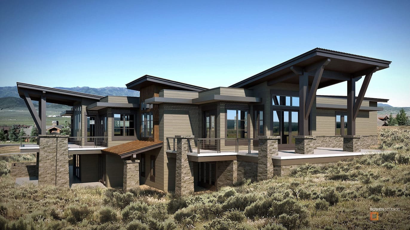
Photorealistic exterior renderings by Bowen Studios bring plans to life, showing how spaces will actually function and feel. This visual clarity builds public trust, reduces costly miscommunication, and allows communities to take part in shaping their future. At its core, architectural visualization is the process of turning concepts into visual experiences, forming the foundation for the advanced applications now shaping urban planning.
Why Large-Scale Visualization Matters for Cities and Communities
Urban planning decisions impact thousands of people at once. Roads, transit systems, and green spaces do not exist in isolation but affect the daily rhythms of entire neighborhoods. Traditional tools such as blueprints often fall short in helping residents and officials fully grasp these impacts.
Architectural visualization fills this gap by showing projects as they would exist in the real world. In particular, exterior 3D architectural renderings illustrate how scale, lighting, and context influence the experience of civic spaces in a way that static plans cannot. Traffic flow, pedestrian movement, and environmental effects can also be modeled with a level of detail that encourages collaboration rather than conflict. When governments present visual models, residents are more likely to understand the reasoning behind a project and offer informed feedback. According to the Federal Highway Administration, design visualization is now a required component of most large-scale infrastructure and transportation projects because it ensures clarity and supports public involvement.
Key Applications of 3D Rendering in Public and Civic Projects
Neighborhood and Master Planning
When entire communities are being designed or redeveloped, 3D models make the vision tangible. Planners can simulate zoning layouts, density, and traffic flow, while also showing how green spaces connect with residential and commercial zones. This helps residents and city officials evaluate how a neighborhood might feel to live in, not just how it looks on paper.
Transportation and Infrastructure
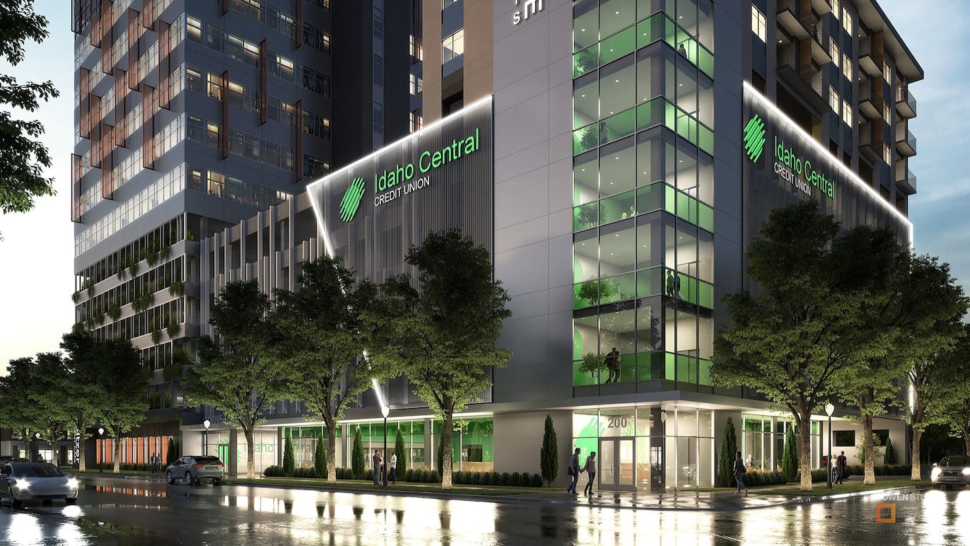
Large-scale projects such as airports, train stations, bridges, and highways require public support and careful planning. Visualization demonstrates scale, anticipated capacity, and integration with surrounding communities long before construction begins. This reduces the potential for disputes and accelerates the approval process by showing projects in a realistic context.
Smart Cities and Sustainability
Visualization is also being applied to sustainability-focused projects. By modeling sunlight, scale, and massing, planners can better evaluate design efficiency and environmental impact. These tools allow civic authorities to refine ideas before committing resources, leading to greener and more resilient communities.
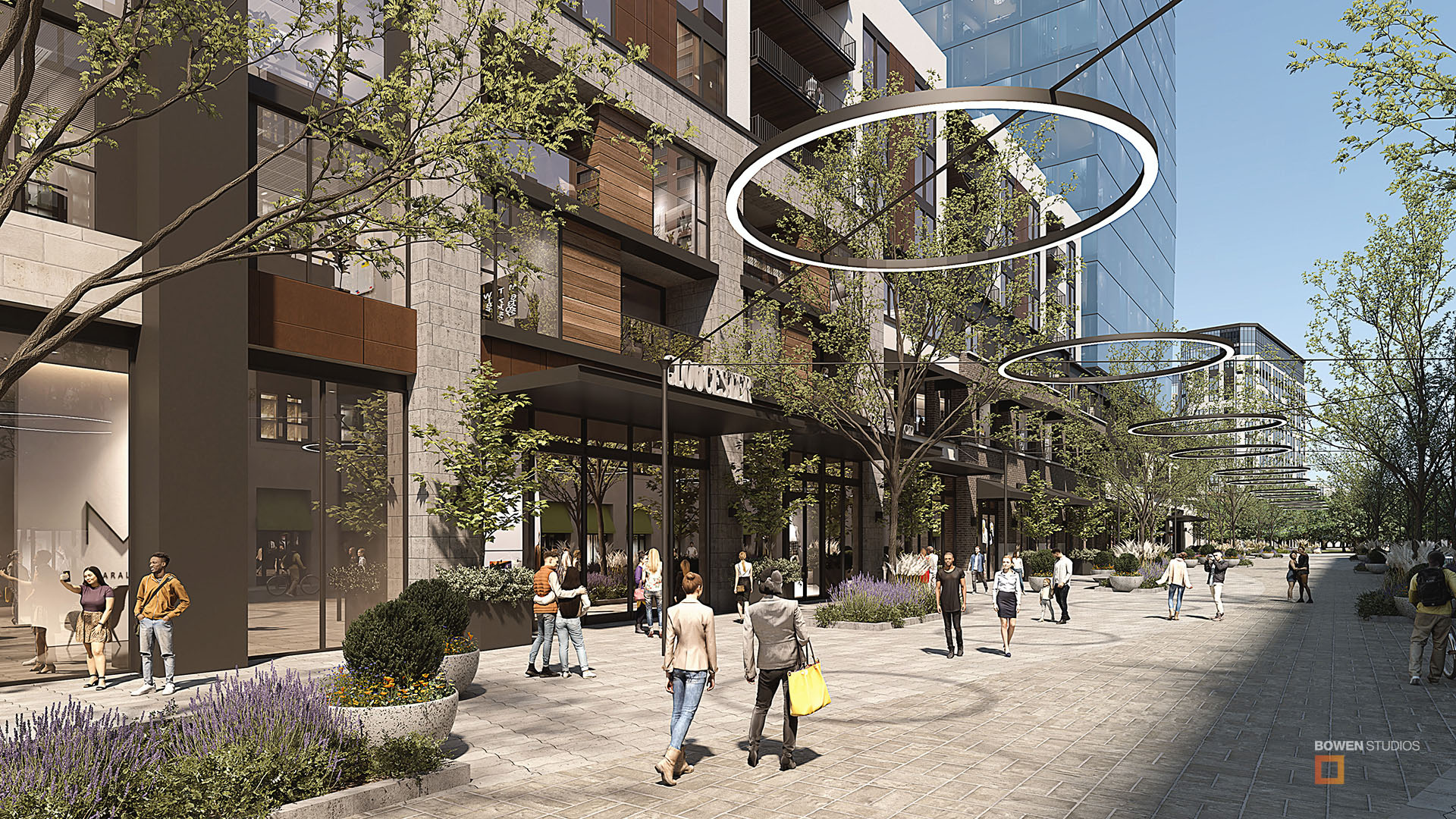
Public Spaces and Civic Engagement
From parks and plazas to cultural centers and waterfront redevelopments, public spaces are best understood when they can be “experienced.” Photorealistic renderings and virtual tours allow residents to explore new environments digitally. This not only builds excitement but also provides valuable input before construction begins. Communities feel included in the process, and governments demonstrate transparency in decision-making.
Visualization as a Tool for Civic Dialogue
Unlike technical schematics, 3D renderings serve as storytelling tools. They translate data-heavy plans into visuals that anyone can understand. For example:
- Residents can see how a new rail line will connect to their neighborhood.
- Communities can evaluate proposed designs for a new park or cultural hub.
- Officials can demonstrate how environmental goals will be supported through thoughtful design.
By making information accessible, visualization strengthens democratic dialogue and fosters collaboration. Projects that once felt abstract become experiences that people can connect with. The National Academies of Sciences, Engineering, and Medicine reports that agencies are increasingly using visualization throughout planning lifecycles to enhance public understanding and build trust in infrastructure projects.
How Municipalities and Developers Benefit from City Planning Visualization Tools
For municipalities and private developers, the advantages are both practical and strategic. Visualization helps prevent costly disputes by ensuring that plans are clearly communicated. It accelerates approvals by showing compliance with zoning and environmental guidelines. It also builds stronger trust among residents, investors, and regulatory bodies.
Professional studios like us here at Bowen provide 3D rendering services that align technical accuracy with compelling imagery. This balance allows decision-makers to present projects in a way that resonates with both officials and the public.
Data-Driven Design Beyond Buildings
At this scale, architectural visualization is not simply about producing striking images. It is about integrating visual communication into decision-making processes that shape entire communities.
- Renderings help illustrate environmental considerations such as sunlight and scale.
- Visual storytelling clarifies how infrastructure fits into its surroundings.
- Interactive presentations make public meetings more engaging and accessible.
By connecting visualization with analysis and communication, cities move beyond static presentations and toward more inclusive, informed decision-making.
Practical Steps for Planners and Agencies
Municipalities, developers, and civic stakeholders can leverage visualization more effectively by:
- Introducing visualization early in master planning stages.
- Using renderings for both technical evaluation and community engagement.
- Partnering with specialists who can translate complex designs into accessible, human-centered visuals.
These steps ensure that visualization is not an afterthought but a core part of planning and decision-making.
How Bowen Studios Supports Civic and Urban Projects
At Bowen Studios, we work at the intersection of architecture, technology, and civic design. Our team helps cities and developers bring large-scale projects to life through:
- Exterior renderings that show how large civic projects will integrate with their surroundings.
- Virtual tours that allow stakeholders to explore proposed spaces digitally.
- Visualizations that support commercial, hospitality, and single-family residential projects with accuracy and clarity.
Our work goes beyond presentation. We help transform complex designs into meaningful experiences that promote transparency, trust, and informed decision-making. Municipalities and developers interested in these services can explore our case studies to see how visualization has impacted past projects.
Building Cities That People Can See and Trust
Visualization has moved beyond the private sector to become an essential part of urban planning and civic engagement. By making complex projects understandable, it fosters collaboration, accelerates approvals, and helps cities achieve sustainability goals. For communities, it represents a new era of participation and transparency in shaping the places where they live, work, and connect.
Visualization is no longer just about buildings. It is about creating more livable, resilient, and inclusive cities. Contact Bowen Studios today to learn how professional visualization can support your next civic or urban project.
For planners, municipalities, and developers considering how to integrate visualization into upcoming projects, the following questions often come up.
Frequently Asked Questions
How is architectural visualization used in urban planning?
It translates complex plans into immersive 3D renderings that show how infrastructure, neighborhoods, and public spaces will function in real life.
What are the benefits of 3D rendering for public spaces?
Renderings help residents visualize proposed parks, plazas, or cultural hubs before construction, fostering transparency and community engagement.
Can visualization tools support smart city development?
Yes, visualization can model factors like sunlight, space, and scale to support greener and more efficient urban design.
Why should municipalities invest in city planning visualization tools?
They reduce disputes, accelerate approvals, and build trust with the public by clearly illustrating how projects meet community needs.
How does Bowen Studios help with civic visualization projects?
Bowen Studios provides photorealistic renderings, virtual tours, and visual storytelling tailored to urban planning and public engagement.